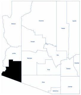
Yuma
Yuma County is located in the southwestern corner of Arizona. As of the 2010 census, its population was 195,751. The Cocopah and the Fort Yuma-Quechan Indian reservations are within Yuma County.
Farming, cattle raising, tourism, and two military bases, the U. S. Marine Corp Air Station and the U. S. Army Yuma Proving Ground, are Yuma County's principal industries.
Two major attractions in Yuma County are the historical Territorial Prison and the Yuma Crossing Historic Park. Other great places to visit are the Kofa Mountain Range and Wildlife Refuge, and Martinez and Mittry Lakes.
Much of the county’s land area consists of desert, accented by rugged mountains that include the Gila Mountains and the Tule Mountains. Several river valley regions contain an abundance of fertile land, which is irrigated with water from the Colorado River.
These areas have some of the richest soils in the world, having received silt and mineral deposits from Colorado and Gila River floods until the rivers were tamed by an intricate series of dams and canals.
Total Area: 5,518.96 square miles
Land Area: 5,514.09 square miles
Water Area: 4.87 square miles
Yuma County features a desert climate with extremely hot summers and warm winters. The coldest month is December when the average temperature overnight is 45.8°F. July is the warmest month when the average daytime temperature rises to 107.3°F.
The lowest point in the state of Arizona is located on the Colorado River in San Luis, where the river flows out of Arizona and into Sonora in Mexico.