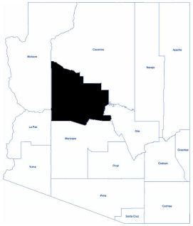
Yavapai
Yavapai County is located near the center of Arizona. As of the 2010 census, its population was 211,073. It is Arizona's fourth most heavily populated county.
The county was named after the Yavapai Tribe, whose name means the "people of the sun." There are three Indian reservations located in the county. They are the Yavapai-Prescott Indian Reservation, the Clarkdale and the Camp Verde Indian Reservations.
Yavapai County lies in the center of a 100-mile strip of Ponderosa pine forest that crosses the state from the northwest corner to the eastern boundary. The Prescott National Forest and portions of the Coconino and the Tonto National Forests are within the county boundaries.
The terrain of the county varies from an elevation of 1,900 feet at its desert low to just under 8,000 feet on its mountain peaks. The diverse terrain includes grasslands, picturesque rock formations, high desert streams, and mountain valleys.
All variations of climate may be found in the county. The lower elevations are desert-like while the higher areas are seasonal with all types of weather. The temperature variation from daytime high to night-time low throughout the year is about 35 degrees.
Total Area: 8,127.78 square miles
Land Area: 8,123.30 square miles
Water Area: 4.48 square miles