La Paz
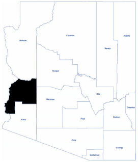
La Paz County is in the western part of Arizona. As of the 2020 census, its population was 16,557. The name of the county is the Spanish word for peace and is taken from the early settlement (now ghost town) of La Paz along the Colorado River.
The Colorado River Indian Reservation is located in the western portion of the county. Tribal headquarters are in Parker, Arizona, the reservation's largest community.
La Paz County encompasses approximately 4,500 square miles of desert, rivers, lakes, streams, mountain ranges, and valleys. It is bordered on the west by the Colorado River, which contributes to the recreational and agricultural industries of the region.
The area has an arid climate, characterized by extremely hot summers and warm winters.
Total Area: 4,513.36 square miles
Land Area: 4,499.95 square miles
Water Area: 13.40 square miles