Gila
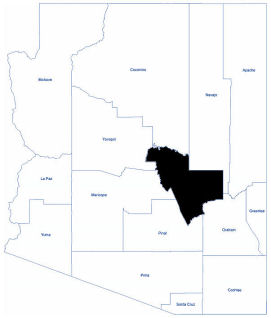
Gila County is located in the central and eastern parts of Arizona. As of the 2020 census, its population was 53,272. It contains parts of the Fort Apache Indian Reservation and the San Carlos Indian Reservation. The county was named for the Gila River, which forms part of its southern boundary.
Gila County has both desert and mountain areas within its borders with over half of the land owned by the U. S. Forest Service. Elevation in the county ranges from 2,123 feet at Roosevelt Dam to 7,153 feet at Mount Ord.
Residents enjoy the four seasons and experience an average high temperature of 73 degrees Fahrenheit and an average low temperature of 39 degrees Fahrenheit. The cooler weather, terrific air quality, and outdoor activities cause many Arizona residents and visitors to migrate to Arizona Rim Country.
Total Area: 4,795.74 square miles
Land Area: 4,767.70 square miles
Water Area: 28.03 square miles