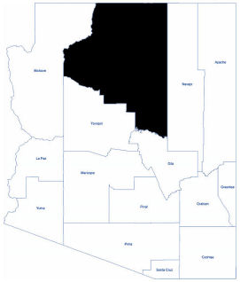
Coconino
Coconino County is located in the north central part of Arizona. It is the second largest county in the United States and the largest in Arizona. The population was 145,101 at the 2020 census.
It has a relatively large Native American population at nearly 30 percent of the county's total population. The county includes part or all of five Indian reservations: Havasupai, Hopi, Hualapai, Kaibab - Paiute, and Navajo, which cover 46 percent of the county’s land.
Coconino County is characterized by deep canyons, rugged mountains, and thick forests of pine, spruce, piñon, aspen, and oak. The county is part of the Colorado Plateau. The plateau is noted for being a high wooded upland cut with many deep drainages, the Grand Canyon being the main one.
The elevation ranges from 2,000 feet along the Colorado River to 12,670 feet at Humphrey's Peak in the San Francisco Mountains. This peak is also the highest point in the state. Most of the county has an elevation of between 4,000 and 7,000 feet above sea level.
The county climate varies greatly from snow-capped high peaks to desert areas to the canyon bottomlands. Windy conditions are prevalent most of the year and at times are accompanied by abrupt changes in weather.
Total Area: 18,661.21 sq. miles
Land Area: 18,617.42 sq. miles
Water Area: 43.79 sq. miles
Within its borders are many scenic sites – the most popular and impressive is Grand Canyon National Park. Other attractions are Oak Creek Canyon, the San Francisco Peaks, Arizona’s highest point at 12,633 feet, and Lake Powell, with 1,960 miles of shoreline.