Cochise
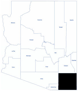
Cochise County is located in the southeastern corner of Arizona. The population was 125,447 at the 2020 census. It is one of only three counties in Arizona without an Indian reservation.
The climate is semi-arid with very warm summers and moderate winters. Precipitation is low except between July and September when the monsoons arrive with strong, but short-lived thunderstorms. Overall, the climate is enjoyable year-round.
Elevation ranges begin at 3,580 feet and rise to the highest point, Chiricahua Peak, at 9,798 feet above sea level. Cochise County is surrounded by the Chiricahua Mountains and Dragoon Mountains.
Snow is common on the mountain peaks. When it snows at lower elevations, it melts within a few hours. Some years there is no snow at all.

Total Area: 6,218.77 square miles
Land Area: 6,169.45 square miles
Water Area: 49.32 square miles